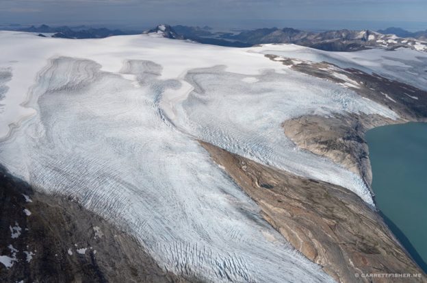
Source: ‚Garrett Fisher / AOPA‚.
Two planned trips fused into one when a long streak of unusually favourable weather appeared in the forecast, resulting in over 24 hours in the air, flying a Piper Super Cub from the bottom of Spain to Norway. The marathon of the flight was driven in the first instance by a plan to spend a little over two months in Norway, flying around glaciers in the summer. The Super Cub was in southern Andalusia, Spain, not far from Africa, after spending a few weeks during the spring holidays wandering around the coast. I had planned to fly the aircraft to Switzerland and then deal with getting it to Norway a month or so afterwards.
I have this image of Scandinavia, particularly the west coast of Norway, where the airplane ultimately would be headed. It was a visual of nonstop lashing rain, low clouds, intense winds, and generally vile weather, with sun three or four times a year. It is not that unfounded of a notion, as Bergen, Norway, is one of Europe’s rainiest cities, receiving almost double the precipitation of Portland, Oregon.
A heat wave was brewing in Spain, so I decided it was time to leave. What was curious was the weather forecast. It showed pleasant weather (naturally) in Spain, with VFR in France the next day. For days three and four, a strong high-pressure zone was forecast to form over Denmark, resulting in sunny skies from Belgium through the Netherlands, northern Germany, Sweden, and southern Norway. To get VFR stretching from 36 degrees to 59 degrees north latitude in Europe for four consecutive days is not something I deem common, so I was inspired to go direct to Norway.
A few fortuitous events made the trip appear to make more sense. The sellers of the Super Cub, from whom I bought it six months prior in Norway, are happy to lend hangar space while the airplane sat for a month. A mechanic I knew would be in Halmstad, Sweden, while I was passing through. It was one of my planned overnight stops, and I needed to discuss some modifications and plan the renewal of the airworthiness certificate, which must be done alongside an annual inspection. With a dose of tossing caution to the wind, I decided to make a run for it. It would be four days in the air and my longest European cross-country.
After departing Trebujena, Spain, over Seville’s control zone, the flight ventured into something visually like the American West. It is a semi-arid region with dry summers, like California. The resulting terrain looks something like one would find in southwest Montana, albeit with lower undulating mountains, many scrub pine forests, and intermittent farming. This goes on for three hours until approaching Madrid, for the first fuel stop at Casarrubios del Monte. It is worth noting that the lower airport density in Europe causes some element of anxiety. There are more airports in southwest Montana than in this stretch of Europe, though Spain is more densely populated. None of the reasonable alternates had fuel, so it required 75 per cent of my fuel capacity to get to the first refuelling point.
I visited Casarrubios in 2018 when crossing the PA–11 Cub Special from the Pyrenees to the Portuguese coast. It is a friendly, nontowered airport with aerobatics, fuel, and good general aviation resources. After some hassle with a nonfunctional fuel pump, I was off again for my next destination: Biarritz, France.
Madrid’s control zone is not very flexible, so I had to largely go around it, heading southeast, then due east, then eventually to the northeast half an hour later, once free of airliner traffic. Temperatures at this point were in the mid-90 degrees Fahrenheit. I was closer to the ground owing to the cake overhead, though I saw some thundershowers developing in the mountains to the northeast of Madrid. Uncomfortably hot, I aimed for some precipitation, rinsing the airplane off and dropping cabin temperatures. By this point, I had climbed to 4,500 feet due to terrain while still within 1,000 feet AGL, as temps had calmed down.
Semi-arid terrain gave way to thick pine forests, which were giving off small clouds of pollen, a phenomenon I had experienced when I lived in the Pyrenees. I could smell it in the cooler and fresh air. Agriculture featured canola fields in full bloom, a display of bright yellow that I would see in great abundance along the German coast approaching Denmark two days later.
There was a concern about precipitation, as what appeared to be orographic thunderstorms started to show more alignment with a small front coming through. The showers I sought to cool me off became unavoidable as I found myself flying in the rain, wedging around them to stay VFR northeast of Soria, Spain, before crossing the ridge into the Ebro Valley.
Further south of this point, the Monegros Desert begins. I experienced a similar event in June 2018, flying east from Madrid to the Pyrenees. I went from broken clouds, humidity, and cold to summer temperatures, sunshine, and a desert within 20 minutes. While it wasn’t quite a desert, once I left the terrain between Soria and Pamplona, the sun came out, and things were clear.
I stayed at 5,000 feet as the 30-minute crossing of the lower plains featured the hills of Basque Country on the other side. There was no point descending, only to climb back up again, particularly as I was on another long leg, which would use most of my fuel. As I approached the hills north of Pamplona, the vegetation turned lusciously green. Over the first ridge, in the direction of the Bay of Biscay, it looked like East Tennessee: rolling steep Appalachian-style hills with rich, green deciduous forests.
Within 20 minutes, I was handed off to Biarritz Tower and made my approach toward the Atlantic Coast near the border. From there, the circuit calls for following the coastline for five minutes, then a one-minute final into the airport. I had landed here two months earlier on the way down to Spain. At the time, the fees were agreeable, though apparently, things changed from winter to summer, so I was handed an almost $50 landing fee invoice. While I was fine with paying it, I took issue with the fact that the FBO claims that there is no bathroom, requiring pilots to walk half a kilometre, leave the airport, clear „security,“ and walk back. Pressing the matter, I asked if the customers that come in on private jets to this FBO have to walk the same distance. The „VIP“ package includes the use of a toilet. „How much if I do not want the VIP package to urinate in the bathroom?“ „Fifty-four euros“ ($65 at the time). No amount of French I spoke, or huffing indignation, changed their minds, so I got my exercise to use the bathroom elsewhere.
Though it was approaching dinnertime, I decided to go 75 miles north, along the coast to La Teste-de-Buch, France, as Biarritz had instrument conditions the previous morning, whereas points north did not. The following morning, my supposition was correct. Biarritz had IFR, whereas it was hazy and overcast over northern Bordeaux. While I would have liked to follow the coast, it would have lengthened an already very long trip. Even still, I could not fathom drawing a line from Bordeaux to Denmark, as it would have been 1,000 miles of repetitive scenery: fields, forests, towns, and some modest hills. Call me a curmudgeon if you must, though I grew up in upstate New York, which looks somewhat similar, absent French châteaux and whatnot. I plotted a course direct northeast of Calais, France, on the English Channel.
The slog through France was uneventful. It was almost three hours to Blois for fuel due to a headwind, passing over the Loire River before landing. I landed on the grass strip, a first for this aircraft, where the Baby Bushwheel felt right at home. Another struggle with a broken fuel pump, then shy of another three hours to Calais, with a flight over the Seine and Giverny, where impressionist painter Claude Monet lived. While it sounds like a fairy tale, I prefer the coast and mountains over farmland.
Calais was an amusing experience. I had read a web of pilot reviews raving about excellent English advertised in the official Aeronautical Information Publication and somehow confused myself. Controllers speak English during the week, but the frequencies revert to French on the weekend, and also with air-to-air uncontrolled communications. French flight following handed me off to the frequency, noting it was „French only.“ I could have diverted elsewhere, though it would have been quite stressful reading AIPs and reviews to see if other airports had fuel, so I decided to dive in with my limited French. Once in the air, confirming that fuel exists at an airport and is open is rather tricky in Europe, which is very different from markings right on the sectional map, or concisely noted in the AF/D in the United States.
The first problem with Calais was figuring out which field was in use. It is a field with lots of parachute activity, so flying overhead to find out is unsafe. I asked in French about the frequency and got no reply. Since I had been facing a northeast headwind all day, I decided to land to the east and announced as such in what was ultimately poor French. The result was a quartering tailwind landing, but so be it. There was plenty of room. After taxiing off the runway, I saw three airplanes lined up to take off to the west, whose pilots all opted not to speak at all (not even in French). I later snarled to a French pilot about French rudeness, and he pointed out: „They were being quite considerate in French terms by waiting for you. Normally they would have just taken off anyway.“
The day’s last flight was along the French, Belgian, and Dutch coasts to Texel, Netherlands. I had been invited by a fellow Super Cub pilot, who is also an aerial photographer. He kindly offered lodging and to hangar the airplane for the night. It was an open question if I could make it before closing, though I was able to with an extension from the information service folks, who stayed a bit later than normal. The flight was pretty along the coasts, and exceptionally so once I got to the Dutch islands northeast of Amsterdam, which reminded me of the Outer Banks of North Carolina.
Dinner with the Dutch pilot was illuminating. He told me a story about photographing as a passenger in a Cessna when they were impacted into the North Sea in the fog, in controlled flight but unable to discern the water visibly. The story reads as though out of a movie: gaining consciousness seconds before submerging underwater, the seat belt not wanting to release, his life jacket getting stuck to the sinking airplane, and finally getting free. He is only alive because he was wearing the life jacket, and he had a 406-Mhz personal locator beacon around his neck before the crash. I purchased both after talking to him and began wearing them if I went anywhere near the water.
The next day was an air-to-air photography session with our respective Super Cubs, lunch after landing on the island of Ameland, Netherlands, and a leg from Ameland to Lolland-Falster, Denmark. I cruised at 2,000 feet over the German barrier islands owing to a protected area. However, I overflew what seemed like an airport on each island (where being below 2,000 feet is acceptable for takeoff and landing). That beckons a return someday to land at each one.
I crossed the top of Germany in Schleswig-Holstein, where approaching the Baltic Sea coast, I was greeted with a sea of yellow canola flowers. It was a 12-mile crossing over water, thinking about the life jacket I was not yet wearing, and then fuel at Lolland-Falster. At this point, I was tracing, in the other direction, the path I had taken out of Norway the prior autumn. There was one last two-hour leg west of Copenhagen, over the Øresund Strait, into Sweden, and along the coast, before landing at the odd closing time of 7:35 p.m.
I booked a hotel for two nights in Halmstad. By midday the next day, the fact that the mechanic was 600 miles to the north left me pondering the philosophical question of what I was doing there. He was not reliable. The weather was perfect, daylight hours long, and it was only 1 p.m. I checked out of the hotel, filed a flight plan (with waypoints every 30 minutes and more than one hour before, a lesson I learned on a previous trip, and took off for Norway).
While it was less than three hours and featured sun instead of half of it being VFR on top like last time, I found myself rather tired. It was the last three hours of a 24.4-hour adventure from the bottom of Europe to Scandinavia. I could enjoy the coast with less fear of death than when I was going the other way. This time, I understood the airplane better and had fantastic weather with beautiful scenery.
I crossed into Norway, then over the Oslofjord, which I could see this time. Last time, it was nothing but solid overcast below. Before landing at TORP Sandefjord Airport for customs, I had to hold over the stunningly beautiful coastline. That featured some waiting and then a phone call to the customs office, who said I could be on my way. I find it ironic as I was examined thoroughly on the outbound leg, where I confessed to buying the airplane and exporting cheese.
The hop to Skien was only 20 minutes. I tucked the airplane into the exact spot where I had bought it six and a half months ago. It would sit for 45 days before I would return to Norway to begin the glacier attack. While I had a sense of accomplishment due to the length of the flight, I also knew that more intense flying lay ahead than behind.
The flight covered eight countries and went from 36 to 59 degrees north latitude, the same as going from Monterey, California, to Skagway, Alaska.
Diesen Beitrag teilen mit:
Gefällt mir:
Gefällt mir Wird geladen …