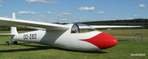
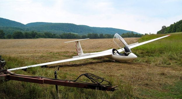
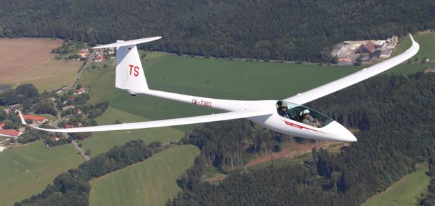
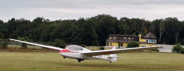
David Stevenson fliegt am 6. April im Hangaufwind der Appalachen an der US-Ostküste mit einer Ka6 von Schleicher vom Startort New Castle aus beinahe 1’100 km und demonstriert damit, was selbst mit einem der letzten reinen Holflugzeug bis heute an Strecken-Distanzen möglich ist. (Noch) nicht überliefert ist, wie er im spartanisch ausgerüsteten Oldtimer den Zehn-Stunden-Flug körperlich überstanden hat. Quelle: ‚OLC, Online-Contest‚.
Thermals, those invisible pillars of rising air that we as glider pilots rely on for sustenance in the sky, they are a fascinating meteorological phenomenon for us all. Understanding how thermals develop is essential, for a good flight and how long one might stay in the sport! Let’s delve into the intricacies of thermal formation and explore the processes that give rise to these vital elements of flight.
Thermals owe their existence to the sun’s radiant energy, which warms the Earth’s surface unevenly throughout the day. As sunlight strikes the ground, different surfaces absorb and retain heat at varying rates. Dark surfaces such as asphalt or ploughed fields absorb more solar radiation and heat up quickly, creating localised areas of warm air near the surface. Conversely, lighter surfaces like sand or grass reflect more sunlight and retain less heat.
As the warm air near the surface expands, it becomes less dense than the surrounding cooler air. This buoyant air begins to rise, forming a thermal updraft. The process is akin to boiling a pot of water on a stove, where warmer water at the bottom rises while cooler water sinks to replace it. In the atmosphere, this vertical movement of air sets the stage for the development of thermals.
Topography also plays a crucial role in the formation of thermals. Mountainous terrain, for example, can enhance thermal development by acting as a natural barrier to airflow. As sunlight heats the slopes of mountains, pockets of warm air are generated, creating strong updrafts along the mountainsides. We as glider pilots often seek out these ridge thermals, to gain altitude, extend our flights & overall cross-country speed.
Additionally, wind patterns influence the behaviour and distribution of thermals. Light winds can allow thermals to form and persist over a given area, while stronger winds may disperse or distort a thermal structure. Convergence zones, where air masses of different temperatures and moisture content meet, can also trigger the formation of thermals as warm air is forced to rise along the boundary between the converging air masses.
The timing of thermal development is closely tied to diurnal cycles, with thermals typically becoming stronger and more abundant during the middle of the day, as solar heating reaches its peak. However, thermals can also form during the nighttime under certain conditions, such as when warm air trapped near the surface by an inversion layer begins to rise as the air above cools!
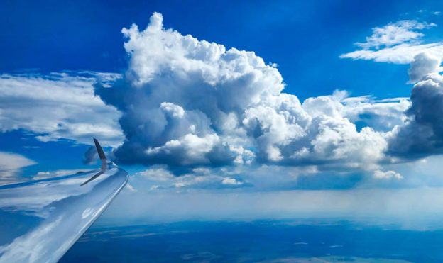
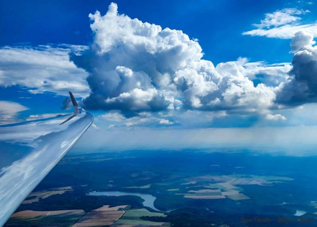
Once thermals break away from terra-firma, thermals can grow in size and strength as they ascend through the atmosphere. The rising air cools adiabatically with increasing altitude, causing moisture to condense and form clouds under the right conditions. Cumulus clouds, characterised by their fluffy appearance and cauliflower-like shape, often mark the presence of thermals in the sky, providing visual cues for us to locate and exploit.
The development of thermals is a dynamic interplay of solar heating, surface properties, topography, and atmospheric conditions. These rising columns of warm air not only sustain our flights but also contribute to the complex dynamics of weather systems. By understanding the processes behind thermal formation, we can gain insight into the intricate workings of the Earth’s atmosphere and the marvels of flight that it enables us to enjoy! Source: ‚Wings and Wheels‚.
Gliding is a sport that has captivated the hearts of many over the decades. The sensation of soaring through the sky gracefully, unaided by engines or propellers, but by Mother Nature is a dream come true for many aviation-inspired enthusiasts. To allow us to achieve this silent dance with nature and the earth’s energy, one of the lift sources that glider pilots rely on, is a phenomenon known as thermals. In this article, I will try to explore the fascinating world of thermal generation, its challenges, and the importance it has in a glider pilot toolkit.
Understanding thermals Thermals are columns of warm, rising air created by the uneven heating of the Earth’s surface. This natural phenomenon is the foundation of thermal generation in gliding. When the sun warms the ground, it heats the air directly above it. Hot air is lighter than cold air, causing it to rise. As the warm air ascends, it cools, and moisture in the air may condense, forming beautiful cumulus clouds.
Glider pilots use these rising columns of warm air to gain altitude without the need for a motor. Riding a thermal is like catching an elevator to the sky. I imagine cumulus clouds to be like the petrol stations of the sky for a glider pilot. The ability to locate, manoeuvre the glider, and then utilise thermals efficiently is a skill honed by glider pilots through training and experience.
The Science of Soaring So, how does a glider pilot find these elusive thermals? The answer of course lies in a combination of keen observations, training, experience and skillfulll flying, which of course can be obtained by all those willing to learn!
Observations: before takeoff, pilots will study the weather, often nowadays with applications like SkySight, or the National Bureau of Meteorology, or talking amongst local pilots to assess the local conditions to identify areas where thermals are likely to form. Once airborne, pilots will look for signs of the development of the cumulus clouds, the behaviour of soaring birds, and the differential in heat on the ground which will cause the trigging of such thermals.
Skilful flying: Once in the air, pilots will constantly scan the landscape for visual cues that a thermal may be nearby, this may include another glider already circling in the column of lift, or sinking to show where not to go! When we encounter this rising energy, we manoeuvre the glider into a circling pattern to stay in it. Those who can race the fastest at gliding competition can find the strongest updrafts consistently…
Navigation: To stay aloft though, and to fly great distances (sometimes gliders can fly over 1000km in a single flight!), pilots must strategically connect these thermals. They will move from one to the next, navigating using their observations from point one, their knowledge of the wind patterns and their intuition about where the next one may be!
Challenges and Rewards Thermal generation in gliding isn’t without its challenges. Thermals can be unpredictable in terms of strength and location. A weak thermal may not even be strong enough to sustain height, while a strong one can require the pilot to make quick judgements as they near the cloud base, and sometimes if we fly high enough we must also use oxygen, as that too decreases with altitude and the pilot can’t risk becoming incapacitated.
However, the rewards of thermal soaring are immense. The joy of silent flight, the satisfaction of navigating the skies using only natural forces, and the thrill of finding and riding the thermals across great distances. It’s a deeply meditative and exhilarating experience that connects pilots with the essence of flight – I highly recommend you extend your own soaring tool kit or if you are interested in gliding, you should definitely give it a try! Source: ‚Adam Woolley, Wings & Wheels‚.
Segelflieger fliegen neuen Vereinsrekord: Die Fliegergruppe Bad Saulgau kann ein neues Rekordjahr in ihrer Vereinsgeschichte verbuchen. Rund 322 Stunden sind die Piloten und Pilotinnen seit Mai auf den vereinseigenen Segelflugzeugen geflogen. Egal ob auf Wettbewerben, im Vergleichsfliegen, Fluglager oder einfach so. Sie waren so viel wie noch nie in der Luft, und dass allein durch die Kraft der Natur „die Thermik“.
Was genau ist eigentlich die Thermik? Um oben zu bleiben, sind Segelflieger/-innen auf Thermik angewiesen. Das ist aufgewärmte Luft, die sich vom Boden ablöst und nach oben aufsteigt. Sogenannte Bärte entstehen über Böden, die von der Sonnen-Einstrahlung besonders gut erwärmt werden. Am Ende der Bärte bilden sich häufig Quellwolken sogenannte (Cumulus). Umso präziser ein Pilot in der Thermik kreist umso schneller und besser steigt er. Das Ziel bei Wettbewerben ist es so schnell wie möglich von A nach B zu gelangen. Wir sind stolz solch aktiven Segelflugpiloten, sowie eine sehr engagierte Jugendgruppe zu haben und freuen uns, dass wir auf ein erfolgreiches unfallfreies Jahr 2023 zurückblicken dürfen, so die Vorstandschaft der Fliegergruppe Bad Saulgau. Quelle: ‚Schwäbische‚.
One of the key skills of gliding is to recognise a thermal as we approach it; there are many ways to do this using ground features, clouds, off mountainous terrain, smoke from a fire, etc. Naturally, we need to find a way to recognise a thermal as we approach it.
Thermal Form Thermals rise through our atmosphere because of a change in temperature, as hot air rising. We must also acknowledge that when a thermal rises, it’ll leave a wake of turbulence in its path upwards. So, the first sign of lift will be some turbulence as we approach it, followed by an increasing amount of sink. What goes up, must go down too right? Often if the sink is really bad, it’s a good sign that the thermal ahead will be a strong one – at least, that’s what I tell myself! As we approach the rising air of a thermal, we can safely assume that the sink will progress from a well sink to a lift. In between this sink to lift, we can expect some turbulence again.
Feeling the Thermal As we transition to this phase, we should think about slowing down to feel our way further into the thermal. Remember, though, to keep your cruise speed up enough to ensure effective aileron control so you can take advantage of the thermal quickly should you need to. A Discus or the like glider, 55-65kts, is ideal, for a ballasted 18m glider, perhaps 65-80kts. The next thing you’ll notice is a surge, the tail coming up and the airspeed increasing ever so slightly, or one of the wings raising, perhaps both at the same time!
Seat of the Pants The key to this next phase is to realise that your personal senses are now the key detection system, as almost all instruments have a delay in them before they register. Our senses are within our inner ear which takes care of our balance, the other is the nerve endings in our backside. Our brain connects all these via a complex algorithm, then advises us of the acceleration, the feeling of lift once we become tuned to it. You’ve probably heard it before, “your seat of the pants” feedback system has an almost instant response time, listen to it!
Sadly, our body can only detect the rate of change, so that’s the initial sink or lift of the glider oneself. Once we are established in a thermal, this is where the audio and visual indicators of the vario system come into play, to show us the rate of thermal. All thermals feel different and the trick to the game is to learn which thermals feel better than the others on any given day, as this is what separates the really fast pilots from the fast ones. I almost forgot to mention, once you determine that you’re in one of these elusive thermals, turn towards the rising wing and try to stay in it – happy thermalling! Source: ‚Adam Woolley / Wings & Wheels‚.
Thermals, those invisible columns of rising warm air, are a glider pilot’s best friend. These natural updrafts allow pilots to soar effortlessly through the skies, conserving energy, and extending flight time, and distances covered. While thermals are commonly associated with high altitudes, where they can carry us to great heights, they also exist at low altitudes, naturally, where they first begin their life! In this article, we’ll explore the art of finding thermals at low altitude and the basic techniques we can use to stay afloat.
Understanding thermals Thermals are essentially columns of warm air that rise due to temperature differences between the ground and the surrounding air. As the sun heats the earth’s surface, it warms the air above it, causing it to rise. The rising air creates an updraft, which of course is what a glider pilot takes advantage of to stay airborne.
Low-altitude thermals While thermals are definitely easier to find at higher altitudes and are more commonly stronger, they do occur at the lower levels too. They are typically weaker and smaller, less organised than their high-altitude counterparts, making them a bit trickier to find, work and exploit. However, with the right knowledge and skills, we can still find these thermals which will again take us to great heights.
Local geography: Knowledge of the local geography is essential for identifying potential thermal triggers. Features like darker soiled ploughed fields, dry creek beds, subtle changes in the elevation of the ground with the sun’s energy facing onto a windward face, an asphalt road with traffic along it, etc. The simplest way is to imagine yourself walking on the surface with bare feet, wherever you would find it the hottest and most uncomfortable, is usually the best place to go and try.
Wind patterns: Keep a keen eye on the wind direction and its impact on thermal movement. Wind blowing into the sunny side of a slope can create lift while waiting for a thermal to come up the face. Often hot air will pool against a tree line surrounding a paddock, the wind will then trigger the thermal overhead or just downwind of this tree line, this is just one example.
Birds and wildlife: Nature often provides clues about thermals. When you are low, it’s so important to look up, look out, look down. Don’t tense up and focus solely on the instruments, watch for birds circling or just taking off out of a tree, they sure are experts at low-altitude thermals!
Thermal sniffing: While in flight, continuously scan the terrain below and be prepared to go over many trigger sources, always have a plan B, C, or even D in mind before you absolutely have to commit to landing in a field.
Be patient: Finding thermals at low altitude requires patience and practice. Patience may be circling over a hot field with a farmer ploughing, in zero sink, just waiting for the thermal to trigger and form.
Safety First When soaring at low altitude, remember it’s always essential to prioritise safety first. Always have a plan for landing in a field, remember it’s only a game, so if you’re in a difficult situation, it’s far more important to stop looking for lift early and focus on a good safe off-field landing. When flying at low altitude, you will also need the appropriate training and a deep understanding of your own abilities, and your sailplanes.
Thermals are columns of warm, rising air created by the uneven heating of the Earth’s surface. This natural phenomenon is the foundation of thermal generation in gliding. When the sun warms the ground, it heats the air directly above it. Hot air is lighter than cold air, causing it to rise. As the warm air ascends, it cools, and moisture in the air may condense, forming beautiful cumulus clouds.
Glider pilots use these rising columns of warm air to gain altitude without the need for a motor. Riding a thermal is like catching an elevator to the sky. I imagine cumulus clouds to be like the petrol stations of the sky for a glider pilot. The ability to locate, manoeuvre the glider, and then utilise thermals efficiently is a skill honed by glider pilots through training and experience.
The Science of Soaring So, how does a glider pilot find these elusive thermals? The answer of course lies in a combination of keen observations, training, experience and skillfulll flying, which of course can be obtained by all those willing to learn!
Observations: before takeoff, pilots will study the weather, often nowadays with applications like SkySight, or the National Bureau of Meteorology, or talking amongst local pilots to assess the local conditions in order to identify areas where thermals are likely to form. Once airborne, pilots will look for signs of the development of the cumulus clouds, the behaviour of soaring birds, and the differential in heat on the ground which will cause the trigging of such thermals.
Skilful flying: Once in the air, pilots will constantly scan the landscape for visual cues that a thermal may be nearby, this may include another glider already circling in the column of lift, or sinking to show where not to go! When we encounter this rising energy, we manoeuvre the glider into a circling pattern to stay in it. Those who are able to race the fastest at gliding competition are able to find the strongest updrafts consistently…
Navigation: To stay aloft though, and in order to fly great distances (sometimes gliders can fly over 1000km in a single flight!), pilots must strategically connect these thermals. They will move from one to the next, navigating using their observations from point one, their knowledge of the wind patterns and their intuition about where the next one may be!
Challenges and Rewards Thermal generation in gliding isn’t without its challenges. Thermals can be unpredictable in terms of strength and location. A weak thermal may not even be strong enough to sustain height, while a strong one can require the pilot to make quick judgements as they near the cloud base, and sometimes if we fly high enough we must also use oxygen, as that too decreases with altitude and the pilot can’t risk becoming incapacitated.
However, the rewards of thermal soaring are immense. The joy of silent flight, the satisfaction of navigating the skies using only natural forces, and the thrill of finding and riding the thermals across great distances. It’s a deeply meditative and exhilarating experience that connects pilots with the essence of flight – I highly recommend you extend your own soaring tool kit or if you are interested in gliding, you should definitely give it a try! Source: ‚Adam Woolley on Wings & Wheels‚.
Etwas Anlauf am Hang und schon lassen sich Gleitschirmflieger ins scheinbare „Nichts“ fallen. Doch anstatt in die Tiefe zu stürzen, schrauben sie sich mit dem Aufwind hunderte und sogar tausende Meter in die Höhe. Der Grund dafür liegt in der Thermik. Doch was genau hat es damit auf sich?
Definition Thermik Ganz allgemein versteht man unter Thermik aufsteigende Luft, die wärmer ist als die Umgebungsluft. Dieser Aufwind wird durch Sonneneinstrahlung verursacht, welche die Erdoberfläche und die darüber liegende Luft erwärmt. Die warme Luft dehnt sich aus, wird leichter und steigt auf, wenn der Temperaturunterschied zur Umgebungsluft etwa 2 Grad Kelvin beträgt. Diese aufsteigende „Blase“ steigt so lange auf wie die Temperatur mit der Höhe abnimmt. Die Luftblase kühlt sich beim Aufsteigen ab, da sie sich aufgrund des abnehmenden Luftdrucks mit der Höhe ausdehnt. Hat die Luftblase die Umgebungstemperatur erreicht, endet dieser Vorgang. Ist in der Luft genügend Feuchtigkeit vorhanden, können sich Cumuluswolken bilden, die die Wolkenthermik markieren. Bei sehr trockener Luft gibt es zwar keine Wolkenbildung, trotzdem aber Thermik. Diese wird dann als „Blauthermik“ bezeichnet. Die aufsteigende Luft wird vor allem von Gleitschirm- und Segelfliegern genutzt, um ohne Motor an Höhe zu gewinnen. Bei guten Bedingungen können so auch größere Strecken geflogen werden.
Je besser sich der Boden aufheizen kann, desto besser für die Thermik. Dabei wird beispielsweise Asphalt oder ein trockenes Getreidefeld deutlich schneller aufgeheizt als Wälder oder Seen. In den Monaten von April bis Juni ist in der Regel die beste Thermik zu erwarten, da dann in der Höhe oft noch kältere Luftmassen vorhanden sind. Neben der Sonneneinstrahlung und der vertikalen Schichtung spielt auch die Großwetterlage eine Rolle. Mit der Strömung und je nach Windstärke kann die Thermik „zerrissen“ werden und die Thermikblasen in kleinere Blasen aufgeteilt werden. Zudem kann aufziehende hohe Bewölkung die Thermik rasch dämpfen oder zum Erliegen bringen. Günstig ist hingegen eine Wetterlage mit nur schwachen Strömungsverhältnissen.
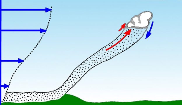
Stärkere Thermik im Gebirge Eine weitere wichtige Rolle für die Thermik spielt die Topographie. In den Bergen ist die Thermik in der Regel stärker als über dem Flachland. Durch das geringere Luftvolumen in Bergtälern werden diese schneller erwärmt und auch Luftblasen steigen im Gebirge von einem höheren Punkt aus und erreichen damit auch größere Höhen bis zur Kondensation. Aus diesem Grund wird auch häufiger ohne Motor in den Mittelgebirgen und Alpen geflogen als im Flachland! Die Dauer der Thermik ist dementsprechend auch von verschiedenen Faktoren abhängig. Im Sommer ist sie in der Regel ab ca. 10 Uhr nutzbar und endet ein bis zwei Stunden vor Sonnenuntergang. Bei länger anhaltendem Hochdruckwetter wird die Luftschichtung stabilisiert und die Thermik wird im Hochsommer um weitere Stunden verkürzt oder komplett unterbunden.
Die Nutzung der Thermik für den motorlosen Flug will gelernt sein. Starker Wind, Turbulenzen und Gewitter können da sehr gefährlich sein. Mittlerweile gibt es aber gute Modellberechnungen für die Vorhersage der Thermik. Diese können sowohl die Stärke als auch die Dauer prognostizieren, so dass berechnet werden kann, ob ein Flug bei der jeweils aktuellen Wetterlage möglich ist oder nicht. Quelle: ‚DasWetter.com‚.
We all like a light to moderate wind day because it’s beneficial for the generation of thermals and it’s relatively predictable. On strong wind days though, we tend to leave the hangar doors closed because they break the thermals up and can be harder to find, especially near the ground! The good thing is that even on these days, the hot air still sticks to the ground as they move downwind during the growing process. Finally, an obstacle is encountered, and the thermal separation from the surface. What is this obstacle? It can be a group of trees or tree line, a farmhouse, a cool dam, vegetation change, neighboring scrub, a car driving down a country road, or even a change in slope. (Editors note: I recall my grandfather telling a story of his imminent outlanding in a new Ka-6 when flying over a field with a tractor plowing it. The moving tractor helped separated the warm air from the ground allowing a thermal to take him away.)
Thermal Genisis The warm air is continually being pooled and continues to be pushed along the ground, drawing it in, and feeding the thermal, even after the thermal has fully established itself. Under the center of the thermal, a lower pressure is developing with a positive side effect. It causes more warm air to be sucked off the ground along the thermal path of the ever-so-gradually shrinking hot air reservoir, prolonging the life of the thermal on windy days. What does this mean? Simply, we may be wasting our time looking for thermals overhead the trigger source as we would normally do on light wind or calm days. Basically, we must look downwind of the trigger point!
Leaning Thermals For sure there’s no disputing that thermals drift over the ground in relatively flat terrain. In mountainous terrain, well, that’s another story and not my specialty, but the trigger source and thermal will remain relatively stationary. What happens over the flatlands though? As you’ve probably seen, clouds drift, always in the direction of the upper wind! So do thermals lean over or do they drift downwind in a vertical column?
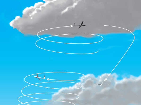
Drifting Thermals Personally from my experience, thermals drift downwind in a vertical column of air, rather than lean. Thermals also seem to generate from the same position on a semi-regular basis too in this situation. But older clouds downwind don’t dissipate? This is usually because they are drawing in air from nearby decaying clouds or still have warm air feeding them in general. To support the vertical column of air theory rather than a leaning thermal is that when you join a gaggle of gliders, you’ll often join them from immediately below or above them, even on moderate to strong wind days and thousands of feet apart from the already established glider.
On windy days, it takes some practice to find thermals quickly without wasting too much time. It’s useful to always look down to try to find the trigger source when low, from around 2-3000’ AGL, as there’s less ambiguity around where the thermal came from, the higher up the more imagination you need! Once you are able to identify where the thermals are coming from, you’re able to fly from one thermal source to another, greatly increasing your chances of finding lift, then centering quickly to stay in it. Soon this process or thermal finding ability will become subconscious, and our success rate in finding thermals on windy days will increase, resulting in more motivation and enjoyment for our wonderful sport – life’s good. 🙂 Source: ‚Adam Woolley on Wings & Wheels‚. Grafik: ‚Segelfliegen, Grundausbildung‘.
This article is about things to do (and not do) on a cross-country glider flight when you are well below your planned height band, have already selected a field or airport to land in, and are trying to stave off that landing. Within this subject, we must talk about thermaling low, which is a very dangerous practice – especially in windy and gusty conditions. It is also a controversial subject that some writers address by a blanket rule of “don’t thermal below “X” altitude.” While that may be reasonable, I believe the decision on when to abandon thermaling and execute the landing is an individual one that should be determined by the pilot after a careful inventory of many factors including experience, currency (both general and in particular glider), wind and gust conditions, time of day, quality of the field or runway, approach obstructions, personal comfort, degree of tiredness, and (especially for pylon type motor gliders) whether there will be an attempt to start an engine before the land out -requiring more altitude in reserve. While I state no rule about this, it must always be remembered that a land out is just an inconvenience, and something quickly forgotten. But a crash is a disaster that at best reverberates throughout an entire flying career – and at worst ends that career entirely. If there is any question of safety, the decision must be made in favor of terminating the flight.
“Hope is not a strategy” – a note affixed to the instrument panel of Dick Butler’s Concordia
If you fly gliders cross country, you will get to this place sooner or later: The flight has not gone according to plan, we are now low and approaching a land out (either at an airport or in a field) and have only a few hundred feet of altitude (before committing to land) to work with and save the flight. We have already selected our field or runway and decided the approach that we will use to get into it. We are no longer progressing on the course ahead. But there is still some time and spare altitude to work with. So, mindful of Dick Butler’s pithy observation stated above, how can we use that limited time and altitude to maximize the possibility of a “save”? Here are some ideas that have worked for me over the years and that you may find helpful.
Prepare for the fight. It’s only natural to postpone physiological tasks like eating, drinking, and urine elimination until you are high, cool, and relaxed. But that can be a mistake if you have a long tough climb-out battle ahead of you, especially at a hot low altitude. Once you get below say, 2000’ AGL, do a quick inventory of these things and deal with them promptly before you get really low. We must stay hydrated and keep electrolyte levels up to fly well. And the constant pressure of needing to urinate can make the ground seem much more attractive than grinding out a 0.5 kt thermal.
Get the glider as far upwind of the landing target as possible Leave enough altitude for a zig-zag flight path back to the target. This technique allows us to locate and work very weak lifts and still drift with the wind toward the safe landing spot. If we search downwind of the landing spot for lift, a weak thermal will take us away from where we need to be and if the climb is unsuccessful, we can easily consume all of our altitude trying to get back upwind to a rushed landing. If your landing target is an airport runway then try to avoid the traffic pattern in your search area if you can, but still, get the glider upwind as the first order of business.
Do not cover the same ground twice Your search upwind of the target field should be a triangle, a zig-zag, or a sideways “W” that takes you over likely thermal sources (infrastructure, tall buildings, farm silos, rail yards, towers, feedlots, junkyards, large power lines, and metal structures) that will trip or focus thermals. Avoid cool or wet areas like swamps, ponds, fields with puddles, or irrigated crops. You can collapse or expand the triangle or zig-zag flight path depending on changes in your altitude reserve. The problem with heading straight out from the selected landing field toward a single likely thermal source is that if it doesn’t work, you must cover the same useless terrain on the return trip. This wastes time and altitude. Frequently when I review a land-out flight trace for a beginner, I see something like a bow tie or shoelace knot pattern clustered around the ultimate landing spot. That thrashing around back and forth to the same point is a waste of time and altitude. Your final flight trace should not backtrack over itself. Source: ‚Whingsandwheels, Roy Bourgeois‘.
Am Samstag, 18.02.2023, fand das Jahrestreffen für Wellenflieger 2023 im DLR in Göttingen mit informativen und spannenden Vorträge statt. 65 Piloten und Besucher waren aus dem Mittel- und Norddeutschen Raum angereist. Holger Weitzel gab „100 Stunden Erfahrung mit der schnellen Windanzeige Anemoi und ein paar Gedanken dazu…“ in seinem Vortrag zum Besten. Michael Seischab referierte über „3D Windberechnung aus dem bewegten System mit dem ‚HAWK System‘.“
Zeigt das HAWK-System gegenüber dem ANEMOI zusätzlich die vertikalen (Auf-) Winde an, so blieben beide Referenten die Antwort auf die Frage aller Fragen der Segelflieger schuldig: „Wo steht der Bart?“ Lediglich Hinweise auf die 50/50-Regel, Zeitraffereffekt, Vögel, andere Segelflieger und schließlich „Glück“ konnten einen Großteil der Zuhörer im Auditorium nicht überzeugen. Zwei „Blaue Pfeile“ wurden aber in diesem Zusammenhang von keinem der Referenten genannt. Quelle: ‚OLC, online-contest‚.
If you’re a winch pilot, you probably know this all too well, if you haven’t built a small plan before take-off, your flight might end up with a circuit and another launch. For a flight to be successful we must first think about where to go once we release the cable or tow plane.
Plan before Takeoff The easy way to start this process is to select a promising-looking cloud shortly before launch, a sure advantage. Why so? Because you are already ahead of the eight-ball when it’s time to start making soaring decisions, often at low altitudes. Once we release, we must look for it again and assess whether it’s within reach or not. If not, have you picked a backup cloud or ‘house’ thermal to go to? If it is, keep flying towards it while refraining from turning in anything unless it’s a certain lift – always remember though, we must keep gliding back to the airfield with landing height options to spare!
Staying Airborne So with the limited height and time available, we have to get crafty. We also have to remember that it’s not a race at this point, we just need to stay airborne so we can have the opportunity to soar for the day. We should head to our target cloud at the best glide speed or near enough to it.
The same applies to aero-tow too, however, we have a much greater chance of finding lift as we’ll be sampling it on the way up, we will be taken closer or further away at our request, and finally, we can always release when we go through a thermal. If the tow plane starts climbing faster than the average on the way up, it’s likely you’re in a climb. I personally try to stay on to 2000’ to simulate a competition tow, but you may want to get off early to practice a low save.
After Release After release though without a thermal, we practice the same as the winch pilot or we can backtrack to those thermals felt on tow, use caution though, are there other tows inbound on that standard path – lookout out always! Thermals are often wider in diameter and easier to stay in, so a higher tow is often easier again to get away from. Try to head upwind, so that you are drifting towards the home airfield. Our best chance of finding lift is to approach the cloud or hotspot into the wind, this might sound difficult to do, but when downwind straight after release, we don’t care about the wind at altitude, so use the ground wind for now, plus your gliders instruments will help if you have the appropriate ones on board – an Oudie N is excellent for this, the Oudie will also help with having return to airfield glide information too
Tactics The first thermal of the day doesn’t have to be the strongest, we just want to stay up, sample the air, and build our picture of the thermal structure for the day. Remember, it takes a verrrrry long time to lose 1000’ when you’re thermalling in 0.1kt sink – so if you need to buy time while you wait for someone else to help you look for a thermal, this is a good tactic to use, when the other finds a useable climb nearby, you can choose to leave or stay. Source: ‚Wings & Wheels‚.
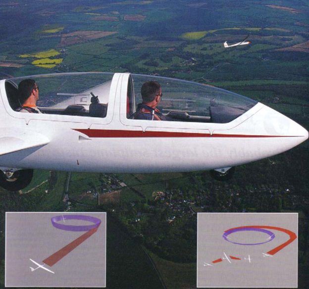
If we are going to be seen by the other glider and keep the other glider in sight, we must first understand the blind spots that gliders have and – more importantly – the situations that might lead to both gliders being in each other’s blind spots.
Before we consider sharing a thermal we will have to think about how we are going to join a thermalling glider. This is where we will need to make certain assumptions. The first assumption is that the circling glider has found a good climb and is already centred on it. This means that no time will be wasted trying to centre the thermal once we join. In order for this to work, it is vital that the other pilot stays in the core and can concentrate on centring it without having to worry about avoiding you.
If we join the thermal in such a manner as to alarm the other pilot then they may move their turn to give them greater separation or comfort; this means that they lose the thermal core and you have to waste time recentring the thermal. In other words: you’ve blown it. Apart from the obvious disadvantages of a lower overall climb rate, the consequences of joining a thermal badly can be that we conflict with the other glider, increasing the risk of collision.
This risk can once again be minimised by a few basic rules:
The first glider has right of way
Join the thermal so that you turn in the same direction
Join in such a manner that the other glider does not have to manoeuvre in order to avoid you
If there is more than one glider and they are thermalling in different directions then turn in the same direction as the one closest to your height
The perfect join is one that places you exactly opposite the other glider, sufficiently far away so that you can remain opposite them with a comfortable angle of bank and speed (see diagram, above right). Before we can do this we must first assess the extremities of the other glider’s turn. This is easy to do but rarely explained. Simply watch the other glider’s turn until you can see it rear-end on, then mark a point on the horizon, which will then mark the boundary of its turn. Provided we fly towards this point we will end up intercepting their turn at a tangent (assuming they don’t alter their turn). If it looks likely there will be no conflict then continue on into the turn (see above page, left) keeping the other glider opposite you.
This method of joining another glider sounds simple enough but is in fact rather difficult to do, and the chances of entering the thermal when the other glider is not opposite you are high. If this looks like the case then we will need to enter the thermal in a spiral fashion. Source: ‚British Gliding Association.
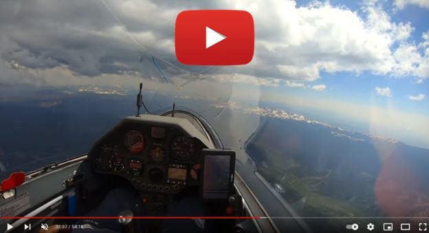
Am 6. Juni 2021 starte ich zu einem Streckenflug mit dem Ziel, den Geschwindigkeits-Rekord von Colorado über eine Strecke von 500 km hin und zurück zu brechen. Eine starke Konvergenzlinie hat sich entlang der Rocky Mountains, direkt östlich des Rückens der Kontinentalscheide, gebildet. Sie soll bis nach Wyoming reichen. Also deklariere ich einen Wendepunkt am Robbins Airstrip, etwa 150 km nördlich der Grenze Colorados zu Wyoming. Die Konvergenz sieht stark aus und ist durch Wolken gut gekennzeichnet, aber ich stelle fest, dass der Tag anspruchsvoll ist. Auf beiden Seiten der schmalen Konvergenzlinie gibt es kaum Aufwinde. Schon das Einfliegen in die Konvergenz erweist sich als Herausforderung über den dicht bewaldeten Hügeln über unlandbarem Terrain.
Das Video zeigt den Flug aus der Cockpit-Perspektive mit ausführlichen Kommentaren zu den atmosphärischen Bedingungen. Außerdem werden einige kritische Entscheidungen während des Fluges hervorgehoben, damit die Zuschauer eigene Entscheidungen überdenken können. Mein Segelflugzeug ist ein Ventus 2cxT, 18m, von Schempp-Hirth. Der Flug begann und endete auf dem Boulder Municipal Airport (KBDU) – einem idealen Segelflugplatz zur Erkundung der Front Range Colorados. Quelle: ‚ChessInTheAir auf Youtube‚.
Viele Vereine zwang die Corona-Pandemie komplett zum Stillstand. Beim Segelflugclub Betzdorf-Kirchen war dies offenbar nicht der Fall, wie nun auf der Jahreshauptversammlung des Vereins hervorgehoben wurde. Kummer bereitet dem Verein allerdings ein Problem, das nichts mit Corona zu tun hat. Auf seiner Jahreshauptversammlung in der Betzdorfer Stadthalle zog der Segelflugclub (SFC) Betzdorf-Kirchen ein positives Fazit des letzten und angefangenen Jahres. Der Vorsitzende, Armin Brast, berichtete laut einer Pressemitteilung des Vereins, dass im Jahr 2020 trotz Corona und damit verbundenem eingeschränktem Flugbetrieb ein Rückgang der rein fliegerischen Aktivitäten nicht zu beklagen war. Nach dem Lockdown im Frühjahr 2020 konnte zwar erst ab Ende April und unter Beachtung des vorgegebenen Hygienekonzepts wieder eingeschränkt geflogen werden und auch die Flugausbildung durfte erst Mitte Mai wieder starten. Der halbwegs „normale“ Sommer, das gute Wetter und ein zweiwöchiges Fliegerlager in Blaubeuren ließen die Pandemie dann aber zumindest zeitweise in den Hintergrund treten.
Positiv konnte auch Cheffluglehrer und zweite Vorsitzender Wolfgang Ermert für die Saison 2020 von ersten Soloflügen und einigen erfolgreichen Prüfungen zur Pilotenlizenz berichten. Das für alle Mitglieder Wichtigste aber war: Der Flugbetrieb lief auch im Jahr 2020 ohne jegliche Zwischenfälle oder gar Unfälle ab. Und das soll dank des gelebten Sicherheitskonzepts des SFC auch so bleiben. Sobald wieder uneingeschränkter Flugbetrieb und auch Gastflüge möglich sein werden, wird der Verein dies zeitnah auf seiner Webseite mitteilen.
Mittelfristiger Flugplatzausbau bewirkt Lärmreduzierung für Katzwinkler Auch die Entwicklung der Mitgliederzahl stellte sich trotz reduzierten Möglichkeiten zur Öffentlichkeitsarbeit positiv dar. Im Langzeitvergleich wuchs die Mitgliederzahl von 150 (2006) auf nunmehr 165 (2020). Davon sind 92 aktive Flieger. Neben einigen Abgängen konnte der Verein 13 Neuzugänge in 2020 verzeichnen. Der in vielen Vereinen beklagte Mitgliederschwund konnte damit offenbar langfristig verhindert werden. Allerdings konnten nur ganz wenige kleine Veranstaltungen realisiert werden. Und das große Flugplatzfest musste wiederum verschoben werden und kann frühestens 2022 wieder stattfinden.
Auch der Fortschritt des Flugplatzausbaus mit dem Ziel der Startbahnbegradigung und Verlängerung machte laut SFC gute Fortschritte. Damit wird der Verein mittelfristig weniger Motorschleppflüge benötigen und zumindest für einen Großteil der Schulung auf die kostengünstigere und leisere Windenschleppart umsteigen. Ein paar Jahre wird diese „Sisyphusarbeit“ aber noch dauern. Danach können sich auch die Katzwinkler Bürger über eine beträchtliche Lärmreduzierung freuen, da die Motorflugzeuge dann beim Start im Schnitt schon gut 50 Meter höher über den Ort rausstarten als heute, was den Lärm der ohnehin schon lärmreduzierten Flugmotoren und Propeller nochmal um gut 35 Prozent verringern wird.
Höhepunkt der Saison, wenn auch erst zum Ende hin, war die Ankunft der beiden neuen leistungsfähigeren Segelflugzeuge des Vereins, dem fabrikneuen Doppelsitzer Arcus-T sowie dem gebraucht erworbenen Einsitzer Ventus-2bx. Mit beiden Flugzeugen verfügt der Segelflugclub nun auch wieder über Maschinen, mit denen der Verein erfolgreich bei Wettbewerben mitmischen kann. Sie ersetzten jeweils ältere Modelle, die veräußert wurden.
Segelflugclub kritisiert Steuerpolitik des Bundes Problematischer als Corona stellte sich für den Verein die verschärfte und restriktivere Steuerpolitik des Bundes dar – eine Entwicklung unter der auch viele andere gemeinnützige Vereine zunehmend zu leiden haben, zumal die angewandten Regelungen rechtlich noch nicht abgesichert sind und jahrelange Diskussionen die Vereine stark verunsichern. „Hier wird das ehrenamtliche Engagement vieler Vereine mit den Füßen getreten und die sichere Zukunftsplanung extrem erschwert. Zu oft müssen die Vereine heute den Rechtsweg gegenüber den Finanzbehörden beschreiten, um zu ihrem Recht zu kommen“, kritisiert der Segelflugclub. Quelle: ‚AK-Kurier‚.
Physik, Aerodynamik, Meteorologie: Der Segelflug ist eine komplexe Angelegenheit. Beim Aeroclub Lichtenfels hat er Tradition. Der Vorsitzende gibt Einblicke in den klassischen Entscheidungssport und erklärt die Faszination dahinter. Das Brummen eines Motors dringt durch die Plexiglasscheibe. Ein kurzer Funkspruch: „Ausklinken.“ Nach einem letzten Ruck dreht die weiß-rote Schleppmaschine nach links ab. Zuvor hat sie die doppelsitzige „ASK 21-D-5810“ auf etwa 800 Meter Höhe gezogen. Der Motorenlärm verfliegt. Nun ist Petra Zimmermann-Lauer in ihrem Segelflugzeug auf sich allein gestellt. Als die Fluglehrerin Quer- und Seitenruder bedient, dreht das Flugzeug nach rechts und gibt den Blick auf Vierzehnheiligen frei. Die Basilika wirkt, als stünde sie in einer Modellbaulandschaft. Der Zeiger des Variometers schwankt, ist aber meistens im negativen Bereich. „Es zeigt das Steigen und Fallen gegenüber der Luft an und ist somit das wichtigste Instrument für uns“, erklärt Gerd-Peter Lauer, der Vereinsvorsitzende des Aeroclubs Lichtenfels. Wenn der Zeiger über der Null steht, dann nutzt der Flieger den Aufwind. Quelle: ‚InFranken.de‚.
Für Segelflieger gelten die gleiche Gesetze wie für die Vögel – sie sind immer auf der Suche nach warmen Aufwinden. Segelfliegen ist nicht nur ein Hobby, nicht nur ein Sport, sondern eine Lebenseinstellung. Segelfliegen – ist das überhaupt ein Sport? Diese Frage höre ich oft. Auf den ersten Blick spricht einiges dagegen: In den meisten modernen Cockpit-Sitzen liege ich schon fast. Die Pedale an den Füßen lassen sich bequem an meine Beinlänge anpassen. Unter mir ein stoßabsorbierendes Sitzkissen. Im Nacken eine gepolsterte Kopfstütze. Klingt komfortabel oder? Na, dann wollen wir mal. Start an der Seilwinde. Beim Start beschleunigt das Flugzeug in wenigen Sekunden von null auf etwa 120 Kilometer pro Stunde. Ich werde in den Sitz gedrückt. Oben klinke ich das Seil aus. Mich verbindet jetzt nichts mehr mit der Erde. Wie lange kann man da eigentlich oben bleiben? Wenn das Wetter passt, fliege ich mehrere Stunden. Dann wird es anstrengend. Im Sommer wird das Cockpit zum Gewächshaus – im Frühjahr oder Herbst werden meine Füße taub vor Kälte. Das klingt jetzt wahrscheinlich nach einem recht einsamen Sport. Stundenlang allein im Cockpit. Segelfliegen klappt aber nur im Team. Alleine komme ich nicht in die Luft. Wenn ich fliege, helfen die anderen Vereinsmitglieder am Boden mit. Am nächsten Tag läuft es andersherum. Für unsere Leidenschaft opfern wir ein ganzes Wochenende. Quelle: ‚Deutschlandfunkkultur.de‚.
Die Wandersegelflug-Daten für dieses Jahr und die Wetterbedingungen sind diesen Sommer gut aufeinander abgestimmt: nach einem ersten Rundflug nach Südfrankreich, das Zentralmassiv, den Jura und die Schweizer Voralpen dürfen wir erneut im Arcus-M-Cockpit für einen Kurztrip durch die französischen Alpen Platz nehmen. Diesmal erwischen wir auf einigen Strecken-Abschnitten auf dem Weg von Schänis in die Haute Provence hervorragende Segelflug-Bedingungen mit einer Wolkenbasis von 5’500 m.ü.M. Das führt zu neuen Herausforderungen.
Psychologischer Vorteil:
der Motor
Anfangs will unser Vorhaben, von Schänis aus in eines der südfranzösischen Segelflug-Zentren zu reisen, nicht recht vorwärts kommen. In unserem Abfluggebiet, den Glarner Alpen, hängt den ganzen Vormittag über die Feuchtigkeit an allen Bergflanken. An ein Wegkommen aus diesem Dampf ist ‘aus eigener Kraft’ nicht zu denken. Dank unseres modernen Eigenstarters können wir aber den Ort und die Höhe, auf der wir den Motor ‘verpacken’ sorgfältig selber wählen. Soweit unser Plan. Ich steure den Arcus M also mitten in die Glarner Hochalpen. Auf Augenhöhe mit dem Piz Segnes stoppe ich die Maschine und gleite im schwachen Hangwind den nach Norden ausgerichteten Bergflanken entlang über den Vorab-Gletscher – und von dort direkt zu den tief gelegenen Thermik-Einstiegspunkten am Piz Mundaun auf der anderen Seite des Vorder-Rheintales. Mir fällt während des Gleitfluges auf, dass der Nordwind für die heutige, flache Druckverteilung erstaunliche Kräfte entwickelt. Das Abwindfeld am Grap Sogn Gion ist beeindruckend – nichts wie weg auf die andere Talseite! Diesen Schritt würde ich offen gestanden ohne den eingebauten Motor kaum wagen. Denn man muss daran glauben, dass die feuchten Wattefetzen knapp über den Kreten des Lugnez brauchbare Aufwinde markieren.
Streckenweise treffen wir auf diesem Flug von Schänis in die Haute-Provence auf die besten thermischen Verhältnisse, an die ich mich in über 30 Jahren erinnern kann – aber wir müssen uns dieses Segelflieger-Paradies mit einem zählen Beginn verdienen.
Wir kommen nicht vom
Fleck
Die ersten Lupfer über dem Val Lumnezia sind wie erwartet
zaghaft – aber es hat wenigstens welche! Ich zirkle zwischen dem deutlich
spürbaren Versatz durch den Nordwind und den Aufwindfeldern die nach Westen
ansteigende Krete zum Piz Nadéls hinauf. Richtig gut geht das nicht, auf
Kretenhöhe ‘rinnen’ mir die Aufwinde jeweils wieder ‘zwischen den Fingern’
hindurch. Hätte ich doch nur mal richtig
fliegen gelernt! Die Lage wird auch am deutlich zerklüfteteren Piz Medel nicht
besser. Am Ende muss Peter die Sache retten und zaubert auf der Westseite des
Val Medel erstmals eine ‘3’ auf die erste Stelle der Höhenmesser-Anzeige.
Nichts ist geschenkt heute. Auch er mogelt sich den Kreten entlang am
Andermatter Gemsstock vorbei an die Furka. Dort kriechen wir mehr über den
hohen Pass als wir fliegen.
Das Oberwallis aus
der Nähe betrachtet
Dann wird unsere Reise etwas zur Nervensache. Keines der vermuteten Aufwindfelder im Oberwallis will uns richtig tragen bzw. durch mindestens eines rausche ich im Übermut auch noch hindurch. Aber der ‘Hätte’, der ‘Könnte’ und der ‘Würde’ sind die am meisten erwähnten Weltmeister! Ich fliege tief, aber wenigstens gezielt weiter über den Flugplatz Münster. Wenn wir sonst schon nichts (Höhe) haben, wir kennen zumindest einen Plan,! Langsam werde ich nervös. Wenn ich hier nichts finde, müssen wir den Motor zu Hilfe nehmen (was mit der Hartbelagpiste unter uns jedoch zu verantworten wäre). Der Segelflieger, der nun auf der Nordseite des Tales (in der Lee-Thermik) aus einer Runse im Wald nach oben steigt, hilft psychologisch auch nicht weiter. Erneut muss ich ehrlicherweise zugeben, dass ich ohne die 65 PS im Rücken schon gar nicht auf die Idee käme, ins Oberwallis einzufliegen.
Aus der ‘Runse zur
letzten Hoffnung’…
In der ‘Runse zur letzten Hoffnung’ zwischen Blitzingen und Reckingen bewegt sich aber die Luft um uns herum endlich und in die gewünschte Richtung. Das Variometer klettert endlich auf brauchbare Werte und ich kann nahe am Gelände mit voller Konzentration und ständigem Schielen auf den Fahrtmesser einen wirbligen Aufwind packen. «So, jetzt kommen wir endlich wieder ins Geschäft!» Das war jetzt richtig knapp, nur wenige Höhenmeter haben noch gefehlt, bis ich den Motor gestartet hätte.
…direkt zum Zischen
der Sauerstoff-Anlage
Mehr als 1’000 Meter kann ich unsere temporäre, fliegende
Wohngemeinschaft in die Höhe ziehen. Über dem Binntal sehen wir erstmals am
heutigen Flugtag die Welt aus einer normalen Segelflug-Optik. Nun ist auch das
stetige, beruhigende Zischen von Peter’s Sauerstoffanlage erstmals im Cockpit
zu hören – ein sicheres Zeichen, dass wir uns in einem komfortableren Höhenband
als bisher bewegen.
Nicht wie sonst
Nun kommt etwas Bewegung in unser Projekt. Denn Peter kann mit ausreichend Geduld über den schotterigen Skipisten von Grächen erneut entscheidende Höhenmeter aus einem verwirbelten Aufwind zaubern. Dieser entsteht erstaunlicherweise nicht wie häufig über dem zackigen Granitgrat des Seetal- und Gabelhorns, sondern versetzt aus den sonnenbeschienenen Talflanken heraus. Da dürfte der Talwind sowie der unvermindert spürbare Nordwind, die zusammen durch das Vispertal hinauf streichen, eine Rolle spielen.
Der Entscheid, weiter nach Südwesten weiter zu fliegen, fällt uns angesichts dieser pröchtigen Aussicht leicht.
Vorwärts-, nicht
zurück-schauen!
Wie auch immer – wir spielen ab sofort in einer anderen Liga und stehen vor dem Entscheid, was wir mit unserer bisher höchsten, erreichen Flughöhe unternehmen wollen. Die Schweizer Luftwaffe ist heute im Dienst, damit ist auf 3’900 m.ü.M. die Maximalhöhe erreicht, auch wenn ich sicherheitshalber bei Geneva Information noch um eine Höhen-Freigabe nachfrage. Im Südwesten sieht die Wetteroptik über dem Gran Paradiso verlockend aus. Zurück will keiner von uns – also los!
Gegenverkehr
Als erstes fädeln wir mit ausreichend Abstand zum bestimmt
vorhandenen Abwindgebiet südöstlich der Dent Hérens ins Valpelline ein. Da ist
allerhand Plastik in der Luft, aus Südwesten schiesst uns auf verschiedenen
Höhen mindestens ein Dutzend Segelflugzeug mit Kurs ‘Matterhorn’ entgegen. Wir
diskutieren einen Moment unsere weitere Flugroute. Die auf den ersten Blick
naheliegendere Variante ohne lange Talquerung zur Grivola, die uns via Petit
St.-Bernard nach Süden führt, gewinnt am Ende. Wir sind danach beide
überrascht, wie stark und grossflächig die Abwindgebiete sind, die südöstlich
des Grand Combin sowie der hohen Gipfel-Kette zwischen Mont Dolent und Mont
Blanc entstehen.
Die Nordseite des Aostatales hält heute eine unerwartete Überraschung in Form saftiger Abwindfelder für uns bereit. Nach dem Höhenflug im Wallis bewegen wir wieder deutlich tiefer durch die Landschaft.
Starke Abwindfelder
Entsprechend schnell bewegen wir uns wieder in einem wesentlich tieferen Höhenband. Abhilfe schafft am Ende nur die schnelle Flucht nach La Thuile am Petit St.-Bernard. Dort schlägt der Nordwind erstens kanalisiert auf einen Berghang, zweitens hoffen wir, da auf Thermik und Talwind aus dem engen Talg der ‘Dora Baltea’ zu stossen, die hinunter nach Aosta fliesst.
Wir können es kaum glauben, aber der Aufwind über Val d’Isère dreht hinauf bis 5’5’00 m.ü.M.
Und der Aufwind des
Tages – alles am Anschlag
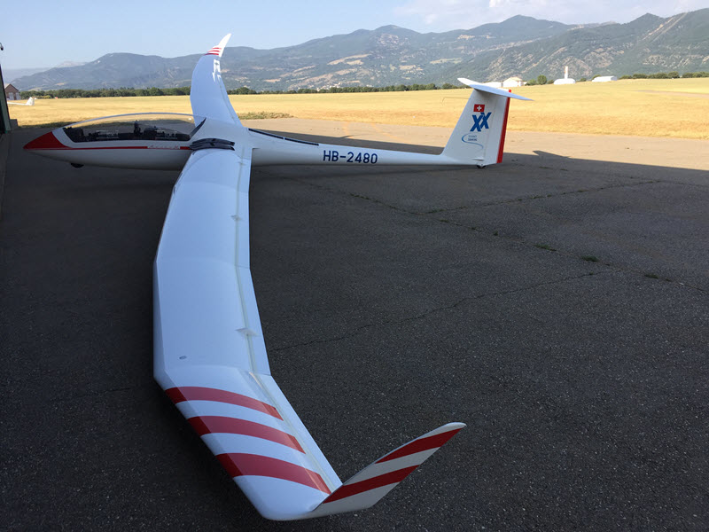
Peter dreht die HB-2480 dort in engen Kreisen geduldig wieder in komfortablere Höhen. Sie ermöglichen uns den direkten Anflug zur Grande Sassière bei Val d’Isère. Dort erwartet uns der Aufwind des Tages. Wir können es kaum glauben. Die Wolken-Untergrenzen liegen hier weit über 5’000 m.ü.M. Der Aufwind ist stark und regelmässig. Genau betrachtet ist zeitweise alles am Anschlag und der Höhenmesser dreht sich wie der Sekundenzeiger einer Armbanduhr.
Das Zischen der Sauerstoff-Anlage ist jetzt dauernd zu hören. Blöd nur, dass ich meinen Anschluss im Cockpit der ASW-20-B zuhause gelassen habe. Dort nützt er gerade nicht so viel. Und wir müssen unseren Steigflug deswegen früher als gewollt unterbrechen.
Der Rest des Fluges ist damit schnell erzählt. Denn mit unserer komfortablen Höhe ist es sicher, dass wir nahezu jedes südfranzösische Segelflug-Zentrum locker erreichen werden. Es geht nun dementsprechend lange geradeaus. Nur über Briançon kann ich einem starken Aufwind nicht widerstehen und klettere nochmals zum Spass ein paar Hundert Meter höher – auch wenn wir damit nichts mehr anfangen können. Hier liegt die Wolken-Untergrenze auf 5’600 m.ü.M. Sowas habe ich in 30 Jahren Südfrankreich-Fliegen noch nie erlebt!
Wir treffen über den französischen Alpen auf perfekte thermische Bedingungen. Die Aufwinde sind verbreitet stärker als 5 m/sec. Die Wolken-Untergrenze liegt weit über 5’000 m.ü.M. Sowas habe ich in dreissig Jahren noch nicht erlebt.
Lufträume! Lufträume!
Die heutige fliegerische Herausforderung besteht nun plötzlich nicht mehr im Finden von Aufwinden, sondern im korrekten Umgang mit den Luftraum-Beschränkungen Südfrankreichs. Denn unsere ungewohnte Flughöhe ist selbst mit Maximal-Speed kaum reduzierbar, weil ‚gefühlt‘ DIE Luftmasse über den französischen Alpen kräftig aufwärts strömt. Ich versuche noch, Freigaben zu bekommen, kann aber auf keiner der dafür zuständigen Frequenzen eine Antwort bekommen. So hilft nur ‘Slalom’-Fliegen’ um ungewolltes Einfliegen in die ‘metallhaltigen’ Durchflugstrecken der Linienflieger zwischen Lyon und Nizza zu vermeiden. Eine nächste Herausforderung ist ausserdem, aus der Fülle möglicher Zielorte einen für uns geeigneten Flugplatz herauszufiltern.
Gesucht:
altersgerechte Unterkunft
Es ist unverändert unser Ziel, nicht in einer staubfreien Hangarecke auf irgendeiner dünnen Unterlage zu ‚übernachten‘ und womöglich einen Hexenschuss einzufangen. Wir mögen es inzwischen lieber komfortabler. So ein Bett z.B. wäre eine praktische Sache. Oder etwa eine Dusche. Und dann wenn möglich noch etwas Feines für die Glättung der heute beim Fliegen während der unvermeidlichen Fastenzeit entstandenen Falten am Bauch zwischen die Beisserchen zu bekommen.
‘Call-Center’ wird
neu definiert
Über die bekannten Flugplatz-Frequenzen können wir lange keine vernünftige Auskunft erhalten, ob eine Übernachtung möglich sei. Ausser in St.-Auban. Da meldet sich subito eine kompetente Auskunftsperson am Funk. Wäre es organisatorisch möglich, hätte er uns vermutlich gleich den Zimmerschlüssel hochgereicht! Das hört sich ja an wie ein Musterbeispiel für professionelles Gäste-Management! Das war es dann am Ende auch. Wir sind hoch willkommen.
Im
Wandersegelflieger-Paradies
Wir treffen in St.-Auban auf eine Art voll ausgestattetes ‘Wander-Segelflieger-Paradies’. Erstens ist da ein Hangar-Platz frei (gegen eine geringe Miete von EUR 15.-/Tag). Zweitens ist die Unterkunft direkt am Platz. Drittens besteht die Möglichkeit, den Benzinvorrat zu ergänzen. Viertens findet abends eine ‘Grill-Party’ für die anwesenden, internationalen Gäste, statt. Und fünftens betreibt der Flugplatz einen Pool! Es geht nicht lange, und wir hüpfen genau da vergnügt hinein. Das ist angesichts der hier gemessenen Temperaturen ein wahres Vergnügen. Das Thermometer kletterte in St.-Auban nämlich auf 43° Celsius. Das ist eine brutale Hitze, auch wenn man sich in dieser Gegend hohe Temperaturen durchaus gewohnt ist.
Der Arcus M findet im Hangar von St.-Auban auch eine passende Bleibe für die Nacht.
Unsere Nachbarn sind
schon da.
Interessant ist auch das Publikum in St.-Auban. Die japanische Segelflug-Nationalmannschaft trainiert für die nächsten Meisterschaften. Eine Anzahl israelischer Piloten geniesst hier die Vorteile weltmeisterlicher Fluglehrer und den relativ freien Luftraum (verglichen mit jenem über Israel bestimmt paradiesisch frei) – sowie Fritz Tresch, Daniel Künzler und Alfred Hörler vom Flugplatz Mollis. Der ist keine 20 Kilometer von unserem Schweizer Heimatflugplatz entfernt. Was für ein Zufall! Wir geniessen einen gemütlichen Abend zusammen und lassen uns das Nachtessen vom Grill mit ausreichend flüssiger Nahrung schmecken.
Peter kämpft entschlossen an diesem Tag mit Temperaturen über 40° C gegen die drohende Dehydrierung .
Horizont-Erweiterung
Was für ein toller Tag! Der Arcus M hat heute wieder gezeigt, wie man mit einem Eigenstarter-System seinen fliegerischen Horizont erweitert. Ohne Motor hätte ich heute zweimal abgebrochen. Aber mit ihm sitzen wir nun gemütlich unter den schattigen Bäumen des Flugplatzes St.-Auban und unsere einzige Sorge ist, wie man die Nacht in einem ziemlich aufgeheizten Gebäude schlau übersteht. Aber davon dann mehr im nächsten Bericht über unsere Rückreise in die Schweiz.
Das französische Segelflug-Ausbildungs-Zentrum in St.-Auban zeigt sich bei unserem Besuch von seiner freundlichsten Seite. Nach dem Pool-Besuch dürfen wir uns gleich bei der Grillparty anmelden.